
Page 14 - Ickford NP Background Evidence
P. 14
14 ICKFORD NEIGHBOURHOOD PLAN : BACKGROUND EVIDENCE REPORT
Water
Ickford and Little Ickford
Summary
National water policies are primarily driven by the aims of There is one Sewage Treatment Works that discharges
the EC Water Framework Directive, as translated into into Worminghall Brook and in 2015 the Environment
national law by the Water Framework Regulations 2003. Agency classified Worminghall Brook as “Moderate meeting
Key objectives include improving the quality of rivers and 2015 objectives”. In addition in 2015, the Environment
other water bodies to ‘good ecological status’ by 2015; Agency classified the Ickford Brook as “Moderate meeting
considering flood risk at all stages of the plan and its 2015 objective. This classification is based on multiple
development process in order to reduce future damage to factors, but the main drivers of the moderate status are the
property and loss of life; and incorporating water efficiency phosphate, invertebrates and macrophytes, all other
measures into new developments. measured factors are currently ranked as “high” or “good”.
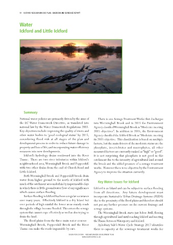
Ickford’s hydrology drains southward into the River It is not surprising that phosphate is not good in this
Thame. There are two river tributaries within Ickford’s catchment due to the intensity of agricultural land around
neighbourhood area, Worminghall Brook and Peppershill the brook and the added pressure of a sewage treatment
with two other drains from the end of Church Road and works. However there is no objective by the Environment
Little Ickford. Agency to improve the situation currently.
Both Worminghall brook and Peppershill brook drain
water from higher ground to the north of Ickford with
much of the catchment area underlain by impermeable clays Key Water Issues for Ickford
in which there is little groundwater flow of any significance Ickford is an Island and can be subject to surface flooding
which causes surface flooding. from all directions. Any future development must
Surface flooding in Ickford has been a regular occurance incorporate Sustainable Urban Drainage Systems (SUDS)
over many years. Effectively Ickford is a dry Island but due to the proximity of the flood plains and therefore should
over periods of high rainfall the lower areas mainly roads not put any further pressure on the current drainage and
through the village become flooded. This enters the sewage sewage systems.
system that cannot cope effectively as well as also trying to The Worminghall Brook starts just below Brill, flowing
drain the land. through agricultural land until reaching Ickford and meeting
The flood plains from the three main water courses – the Thame between Waterperry and Ickford.
Worminghall Brook, Peppershill Brook and the River Aylesbury Vale’s Water Cycle Strategy 2017 identifies
Thame can make the roads impassable by cars. there is capacity at the sewerage treatment works for
VISION FOR ICKFORD – NEIGHBOURHOOD DEVELOPMENT PLAN
www.visionforickford.co.uk